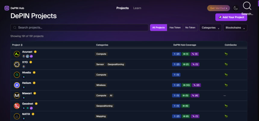
Decentralized physical infrastructure networks (DePIN) are revolutionizing the global travel industry and offering new solutions for connectivity, navigation, transportation, and tourism. In this article, I will discuss the Best DePIN Projects Transforming Global Travel.
I will explore how Helium, Hivemapper, DIMO, NATIX Network, and other leading projects use blockchain, AI, and real-world data to improve travel experiences and create smarter global infrastructure.
How We Choose the Best DePIN Projects Changing the Way We Travel the World
- Real World Utility: Projects addressing real travel and transportation problems.
- Technology Innovation: Blockchain, AI, IoT, GPS, Decentralized Infrastructure.
- Impact on the Travel Industry: Can help improve navigation, connectivity, mobility and tourism.
Data Trustworthiness: Collection of accurate, useful, and accessible real-world data. - Network Adoption: Increasing infrastructure, active contributors and ecosystem growth.
- Scalability: Ability to scale services across countries and global markets.
- Security & Transparency: Trusted data handling, privacy, and decentralized operations.
- Community Participation: High incentives for the people who provide the infrastructure and data.
- Industry Partnerships: Partnerships to support real-world adoption and integration.
- Future potential: Opportunities for sustainable business models and future growth in global travel.
Key Points & Best DePIN Projects Transforming Global Travel
| Project | Explanation |
|---|---|
| Helium (HNT) | Decentralized wireless networks provide connectivity for travelers, devices, and smart transportation systems. |
| Hivemapper (Bee Maps) | Community-powered mapping delivers updated road data, improving navigation and travel experiences worldwide. |
| DIMO | Connected vehicles share mobility data, enabling smarter transportation and personalized travel services. |
| NATIX Network | Decentralized camera networks collect real-time road data, supporting safer navigation and transportation. |
| WeatherXM | Decentralized weather stations provide localized forecasts, helping travelers plan safer journeys. |
| GEODNET | Satellite-powered positioning delivers precise location data, improving navigation and autonomous transportation accuracy. |
| Wing Bits | Decentralized infrastructure supports location-based data services, enhancing travel connectivity and mobility solutions. |
| Render Network (RNDR) | Decentralized GPU computing powers immersive travel experiences, virtual environments, and geospatial visualization. |
| Filecoin (FIL) | Decentralized storage securely preserves travel data, maps, and location-based information globally. |
| Silencio | Community-powered noise mapping helps travelers discover quieter destinations and assess environmental conditions. |
10 Best DePIN Projects Transforming Global Travel
1. Helium (HNT)
Helium is a decentralized wireless network that hopes to deliver affordable connectivity through community operated infrastructure. It allows individuals and businesses to set up wireless hotspots to provide network coverage for mobile devices and Internet of Things (IoT) applications.
It has the infrastructure to support two large services Community-powered Wi-Fi access points with cellular offload and LoRaWAN connectivity for connected devices. In travel, it can enable connected transportation systems
location-based services, smart tourism infrastructure and IoT-enabled asset tracking. Where coverage is available in participating networks, travelers will enjoy improved connectivity. The HNT token incentivizes infrastructure providers and powers the economic model of the network.
HNT (Helium) Best For
- Decentralized wireless connectivity for travelers and connected devices.
Community-powered hotspots extend network coverage. - Supports smart tourism infrastructure and IoT-enabled transport.
enables connectivity for mobile and location-based applications
Helium (HNT) Best Use Cases
- Providing wireless connectivity to travelers and smart tourism devices.
- Linking vehicle tracking systems and IoT-enabled transport.
- Connected sensors and devices enabling smart hotels.
- Extending internet access through community-based wireless hotspots.
2. Hivemapper (Bee Maps)
Hivemapper is a decentralized mapping network that gathers street level imagery and geographic information from dashcams in the real world, operated by the community. Contributors take pictures of roads as they drive, helping create and constantly update a global mapping database.

The technology fuses GPS positioning, camera sensors, artificial intelligence and image processing to identify road features and create useful mapping information. Hivemapper can support transportation companies with improved navigation, updated road conditions, location intelligence, and mapping services for global travel.
Its data can also help developers of autonomous vehicles and mobility platforms to understand changing road environments. In addition, contributors are rewarded with HONEY tokens for providing valuable mapping data, which encourages greater participation in global mapping infrastructure.
Bee Maps (Hivemapper) Best For
- Mapping built by the community with real street imagery.
- Provides regularly updated road and geographic data.
- Enables smarter navigation and routing.
- Allows transportation companies to access useful mapping data.
Bee Maps (Hivemapper) Best Use Cases
- Making new digital maps from road photos taken by local residents.- Helping travelers get around unfamiliar roads and destinations.
- Giving accurate information about roads to logistics companies.
- Continuously updated mapping information to improve route planning.
3. DIMO
DIMO is a decentralized vehicle data network that connects cars, drivers and mobility applications through an open data infrastructure. Vehicle owners can share authorized vehicle information through compatible integrations and connected hardware.
The platform can provide important information such as location of the vehicle, mileage, battery level, fuel consumption, tire pressure and diagnostic information. This information enables smarter transport, vehicle monitoring, fleet management and personalized mobility services.
DIMO can help rental companies, transportation providers and mobility applications build data-driven services in global travel. The permission-based system allows vehicle owners to decide who can access the data and allows developers to create applications using the connected vehicle data.
DIMO Best For
- Connects vehicles to decentralized data infrastructure.•
- Provides vehicle location and mileage and diagnosis information.
- enables smarter mobility and fleet management.
- Enables customized vehicle services and data-based transport applications.
DIMO Best Use Cases
- Connect vehicle data to track rental vehicles.
- Helping fleet operators track vehicle performance and use.
- Delivering vehicle health and diagnostic data to drivers.
- Support data-driven mobility and personalized transportation services.
4. NATIX Network
NATIX Network is a decentralized camera infrastructure project that turns everyday cameras into smart data collection devices. Contributors create real world geospatial information such as road imagery, traffic observations and environmental data via its Drive& app and compatible camera systems.

It uses artificial intelligence technology to process information on devices to identify useful features while putting user privacy first. The network is built to facilitate smart mapping, autonomous driving and physical AI applications. NATIX can provide a useful source of information for global travel, such as information on road conditions, traffic pattern monitoring
Improvements to navigation systems and the development of smarter transportation infrastructure. Its community-driven model incentivizes people to upload useful camera data and to take part in decentralized geospatial information gathering.
NATIX Network Best For
- Turns compatible cameras into geospatial data collection devices.
- It displays road images and traffic information.
- Compatible with AI-powered mapping and navigation apps.-
- Supports the development of a smarter transportation and autonomous driving infrastructure.
NATIX Network Best Use Cases
- Monitoring traffic trends for smarter city transportation systems.
- Powering navigation apps based on crowd-sourced geospatial data.
- Providing autonomous driving systems with access to real-world road data.
- AI-enabled cameras to capture road imagery in real-time.
5. WeatherXM
WeatherXM is a decentralized weather observation network that collects localized environmental data using independently operated meteorological stations. These stations record important atmospheric conditions including temperature, humidity, wind speed, rainfall and air pressure.
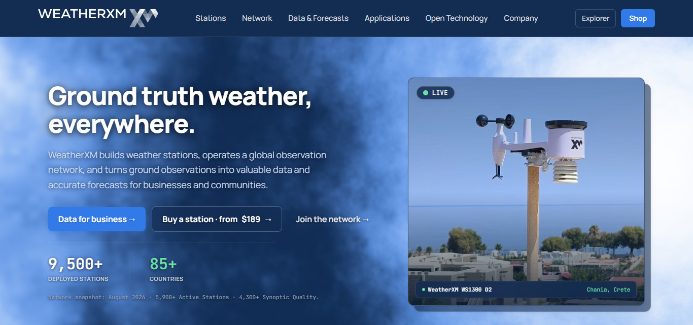
The collected information helps build detailed weather datasets that can improve local weather intelligence and forecasting services. Accurate weather information is critical to the global travel industry for planning road trips, outdoor activities, tourism experiences, and transportation operations.
WeatherXM can provide useful localized observations for destinations with little traditional weather monitoring infrastructure. Its community-driven approach increases availability of weather data, while those providing it help build the network, and earn rewards for providing reliable weather observations.
WeatherXM Best For
- Gathers localized weather data from a network of decentralized meteorological stations.
- Provides measurements of temperature, humidity, rainfall and wind.
- Helps you plan travel and outdoor activities with the weather in mind.
- Helps to improve weather intelligence for tourism destinations.
WeatherXM Best Use Cases
- Providing weather information in a local way for trip destinations.
- Helping tourists plan outdoor activities according to weather forecasts
- Providing weather intelligence to airlines and transportation operators.
- Helping tourism businesses adjust to fluctuating weather conditions.
6. GEODNET
GEODNET is a decentralized geospatial infrastructure network, that provides high accuracy positioning information through community operated Global Navigation Satellite System (GNSS) reference stations.
These stations collect satellite observations and generate correction data that enables compatible devices to achieve much higher positioning accuracy than a conventional standalone GPS. It uses Real-Time Kinematic (RTK) technology, which can get to centimeter-level accuracy in good conditions.
Potential applications of GEODNET for global travel include precise navigation, autonomous cars, drones, smart transportation and location-based services. Accurate positioning can improve the ability of transportation systems to locate places and facilitate advanced mobility applications. Its decentralized infrastructure provides high accuracy positioning resources to developers and businesses around the world.
GEODNET Best For
- GNSS infrastructure for high-precision positioning.
- Centimeter-level positioning is supported by RTK.
- Improves accuracy of navigation and location services.
- Used in autonomous vehicles, drones and smart transport applications.
GEODNET Best Use Cases
- Accurate positioning for advanced navigation services.- Providing very precise positioning information to support driverless vehicles.
- Enhancing drone navigation and aerial surveying operations.
- Precision mapping of smart transportation infrastructure.
7. Wing Bits
Wingbits is a decentralized aviation tracking network that uses community-run ground stations to gather real-time aircraft information. Its infrastructure is built around Automatic Dependent Surveillance-Broadcast (ADS-B) technology, which allows compatible receivers to pick up signals broadcast by aircraft.
Such signals are useful in that they provide such information as aircraft identification, geographical position, altitude, and speed. Combining inputs from independent operators the network can create a more complete picture of global air traffic.
Wingbits is useful in travel like flight monitoring, aviation data services, aircraft tracking, and improved visibility of airspace. Reliable flight information is a resource that airlines, aviation businesses, developers, and travel technology platforms can use to create useful applications. Contributors earn WINGS rewards by sharing useful aircraft tracking data.
Wingbits Best For
- Collects aircraft tracking data from receivers run by the community.
- Tracks aircraft movements using ADS-B technology.
- Supports aviation data applications, flight monitoring.
- Enhances access to decentralized global air traffic information.
Wingbits Best Use Cases
- Tracking of aircraft movements using decentralized ADS-B infrastructure.
- Helping aviation lovers to track the air traffic live.
- Supporting aviation analytics using crowdsourced aircraft data.- Providing flight-tracking data to travel technology applications.
8. Render Network (RNDR)
Render Network is a decentralized GPU computing platform that connects people and businesses with processing needs to operators with spare graphics processing units (GPUs). Its infrastructure is built to support demanding workloads such as 3D rendering, visual effects, animation, generative AI and spatial computing.
It distributes computing tasks through a global network of GPU providers so that creators can tap into additional computing power without having to pay for costly centralized hardware. Render Network has potential applications in virtual tourism

Immersive destination experiences, realistic architectural visualizations, digital twins, and interactive travel environments in the global travel industry. Tourism companies may utilize these capabilities to create immersive destination previews and engaging digital experiences. GPU operators are paid for providing computing power.
Render Network (RNDR) Best For
- Provides decentralized GPU computing power.
- Enables 3D rendering and immersive digital environments.
- Virtual tours and realistic visualization of destinations.
- Enables travel companies to create fun digital experiences.
Render Network (RNDR) Best Use Cases
- To create immersive virtual tours of destinations around the world.
- Creation of realistic 3D models of hotels and resorts.
- Driving digital tourism experiences with GPU computing.
- Assisting travel companies to generate advanced visual content.
9. Filecoin (FIL)
Filecoin is a decentralized storage network designed to store and retrieve data. Simply put, it’s digital storage for digital information and it works through independent storage providers around the world. Its blockchain-based infrastructure uses cryptographic verification
To help ensure the availability of stored data and the storage commitments of providers. The network supports applications that need reliable storage like digital archives, large datasets, media files and Web3 applications.
Filecoin can support global travel by offering infrastructure to store digital maps, destination imagery, tourism information, travel records and geographical datasets. Its distributed storage model is an alternative to complete dependence on centralized data providers. FIL token is used for transactions in storage and to incentivize providers who contribute storage capacity to the network.
Filecoin (FIL) Best For
- Provides infrastructure for decentralized digital data storage.
- Provides a safe place for maps and geographic data.
- Helps in maintaining travel information and digital archives.
- Provides distributed storage solutions for tourism applications.
Filecoin (FIL) Best Use Cases
- Maintaining digital maps and geographic data on distributed infrastructure.
- Preservation of tourism images, videos and destination archives.
- supporting decentralized storage for travel tech platforms.
- Maintaining access to large travel datasets.
10. Silencio
Silencio is a decentralized environmental intelligence network that collects hyperlocal noise information using community-powered smartphone apps. Users upload sound-level measurements which are then used to create detailed noise maps of streets, hotels, restaurants and other public places.
Its technology makes regular smartphones into data gathering devices, allowing the network to build valuable environmental datasets. This information can help tourists to identify quieter hotels, restaurants, accommodation areas and destinations in the global travel industry before making travel decisions.
It can also give hospitality businesses, tourism developers and urban planners a better understanding of noise pollution and enhance visitors’ experiences. Contributors are incentivized to share useful measurements, helping to grow decentralized environmental monitoring infrastructure worldwide.
Silence Best For
- Enables travelers to discover quieter hotels and destinations.
- Environmental noise intelligence for better tourism experience.
- Gathers environmental noise data via community submissions.
- Creates hyperlocal noise maps for various locations.
Silence Best Use Cases
- Helping travelers find quieter hotels and places to stay.
- Knowledge of noise levels around restaurants and tourist attractions.
- supporting destination selection with information about environmental noise.
- Help hospitality businesses understand and monitor noise pollution.
Conclusion
Conclusion The Best DePIN Projects Transforming Global Travel show the capacity of decentralized technology to enhance connectivity, navigation, transportation, and tourism experiences. Blockchain
AI and community-powered infrastructure are providing innovative real-world solutions in projects like Helium, Hivemapper, DIMO, WeatherXM and GEODNET. With adoption, DePIN may be critical to building smarter, more connected and efficient global travel ecosystems.
FAQ
Which are the best DePIN projects transforming global travel?
Helium, Hivemapper, DIMO, NATIX, WeatherXM, GEODNET, Wingbits, Render, Filecoin, and Silencio are notable projects.
How does Helium improve global travel connectivity?
Helium provides decentralized wireless connectivity supporting travelers, connected devices, and smart transportation infrastructure.
How does Hivemapper help travelers?
Hivemapper collects community-powered road imagery, helping improve digital maps, navigation, and geographical information.
What role does DIMO play in smart transportation?
DIMO connects vehicles and provides useful data for vehicle monitoring, fleet management, and mobility applications.
How can WeatherXM and GEODNET benefit travelers?
WeatherXM provides localized weather observations, while GEODNET supports highly accurate positioning and navigation services.